
Postal codes were never designed for modern targeting.
They’re broad, inconsistent, and often don’t reflect how people actually live. Originally built for mail delivery, not data-driven decisioning, postal codes can group together populations that behave very differently, creating gaps between location data and reality.
As use cases become more precise, that gap becomes harder to ignore.
The Need for More Precise Geographic Units
As use cases become more precise, the limitations of postal codes become more apparent.
They were never designed to support modern targeting, measurement, or analytics. Their size, inconsistency, and lack of standardization introduce gaps between location data and how people are actually distributed in the real world.
To close that gap, a more precise geographic foundation is required.
Many countries have developed standardized statistical units designed specifically to represent real-world populations and boundaries. These units offer smaller, more consistent geographic definitions that better reflect how people live.
Unlike postal codes, these units are purpose-built for analysis. They provide a clearer, more reliable way to understand location, making them better suited for modern targeting, measurement, and data-driven decisioning.
A Closer Look at Alternate Area Frameworks
While the concept is consistent globally, many regions have developed their own framework for defining these smaller geographic units.
Australia: SA1 (Statistical Area Level 1)
Defined by the Australian Bureau of Statistics, SA1s are the smallest unit used for census data collection. They are designed to be relatively uniform in population, typically containing between 200 and 800 people, with an average of around 400.
This structure creates highly granular, evenly distributed areas that enable precise analysis while maintaining privacy.
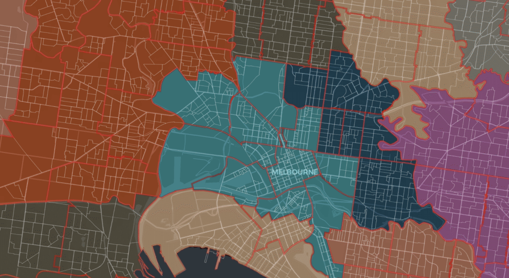
In the image above, the red lines show the postcodes in Melbourne, Australia and the white lines are SA1s.
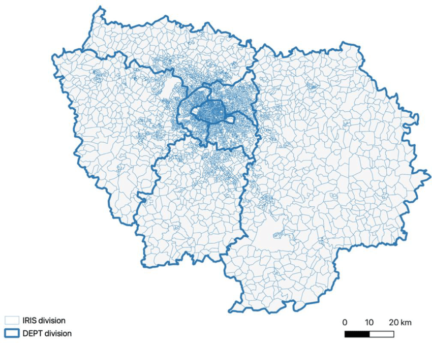
France: IRIS (Ilots Regroupés pour l’Information Statistique)
Developed by Institut National de la Statistique et des Études Économiques (INSEE), IRIS zones represent coherent neighborhoods within cities and towns.
Each IRIS typically contains between 1,800 and 5,000 residents and is structured to reflect meaningful demographic groupings. Compared to postal codes, IRIS provides a more consistent and standardized way to analyze population distribution at a local level.
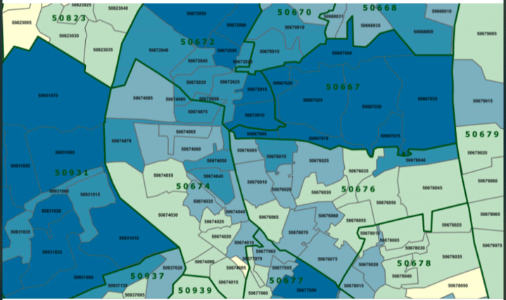
Germany: PLZ8
PLZ8 extends traditional postal codes into a more granular, eight-digit format, breaking larger postcode areas into smaller, more precise segments.
This added level of detail allows for improved geographic resolution in a market where standard postal codes can vary significantly in size and density.
Why Granularity Matters
When location data is too broad or inconsistent, it introduces noise into everything built on top of it.
- Targeting becomes less precise
- Measurement becomes harder to trust
- Insights become less actionable
More data doesn’t solve that problem.
Better inputs do.
Smaller, standardized geographic units provide a stronger foundation—aligning data more closely with how people are actually distributed and enabling more accurate downstream outcomes.
NetAcuity’s Alternate Area Database
That’s exactly why Digital Element developed the Alternate Area Database (AADB).
AADB maps IP data to more granular geographic units like SA1, IRIS, and PLZ8, enabling organizations to move beyond postal code-level approximation and toward true geographic precision.
By aligning IP addresses to these standardized areas, organizations can:
- Improve targeting accuracy with more relevant geographic inputs
- Strengthen measurement by reducing inconsistencies
- Gain deeper insight into audience distribution
- Maintain privacy alignment through aggregated, non-identifiable location data
From Approximation to Precision
As location-based strategies continue to evolve, the quality of foundational data becomes increasingly important.
Postal codes served their purpose, but they were never designed for the demands of today’s ecosystem.
By mapping IP data to smaller, standardized geographic units, it becomes possible to move beyond approximation and toward true precision.
Because better inputs lead to better outcomes.
For more detail on how Alternate Area Database works and where it applies, reach out to support@digitalenvoy.com

